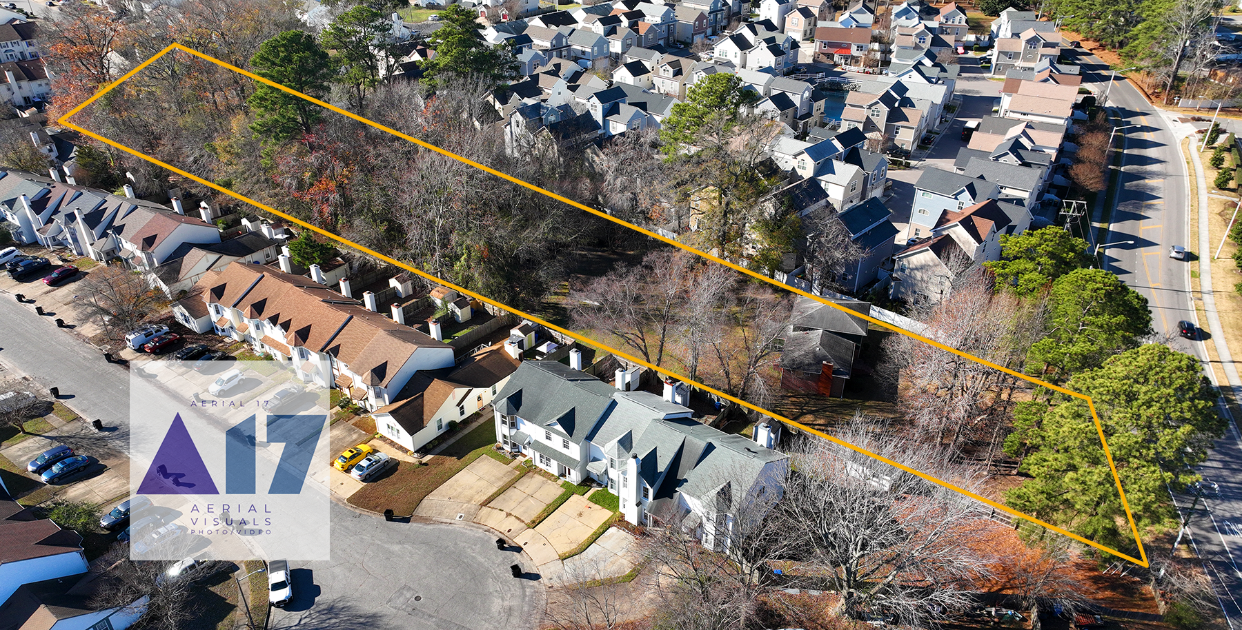
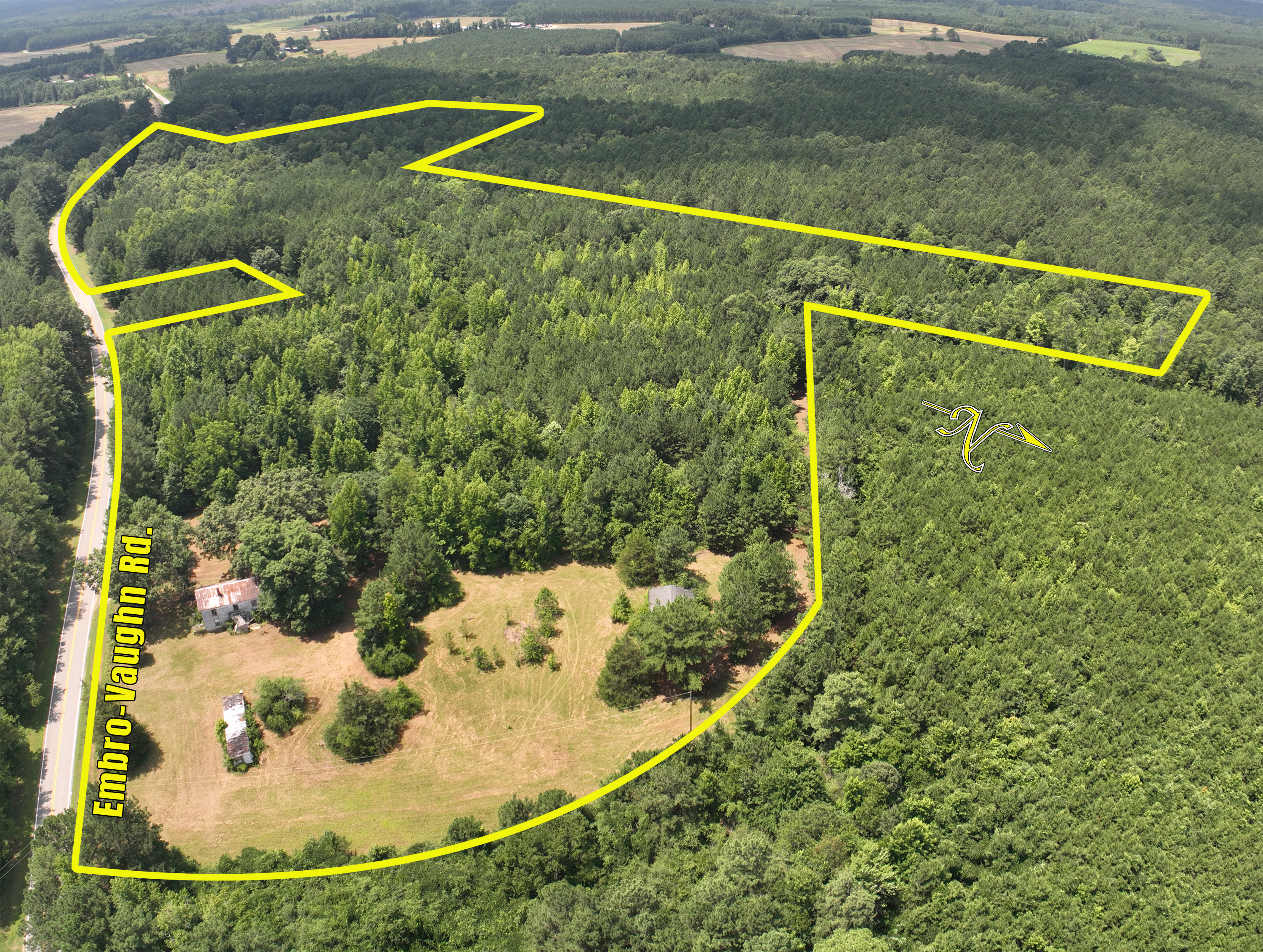
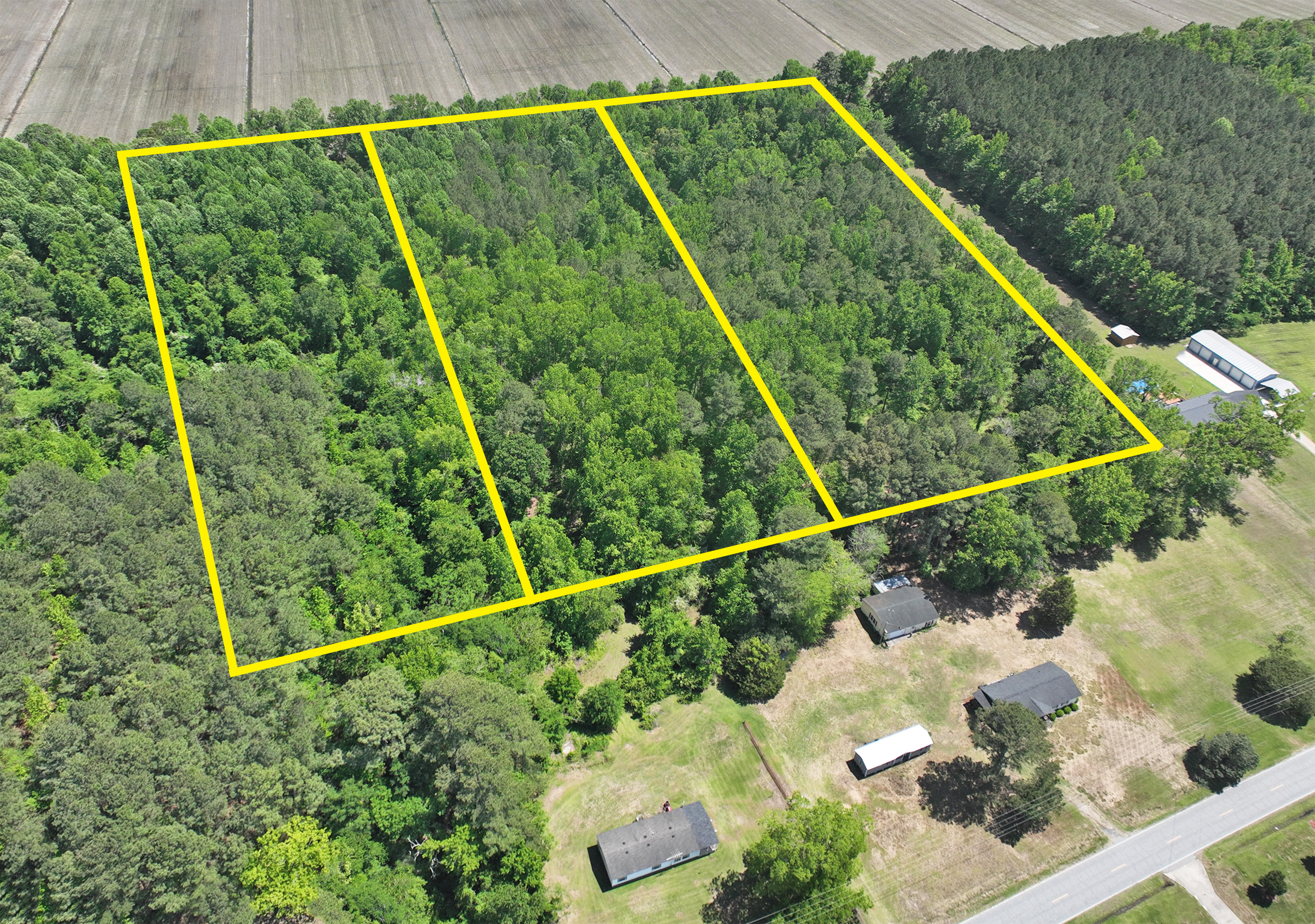
40+ acre property in Macon, NC
Jennifer Schrimper of First Class Real Estate (Rocky Mount NC) contacted us to get aerial images of a 40+ acre property in Macon, NC. We were on site the next day, and delivered marketing images within 24 hours.
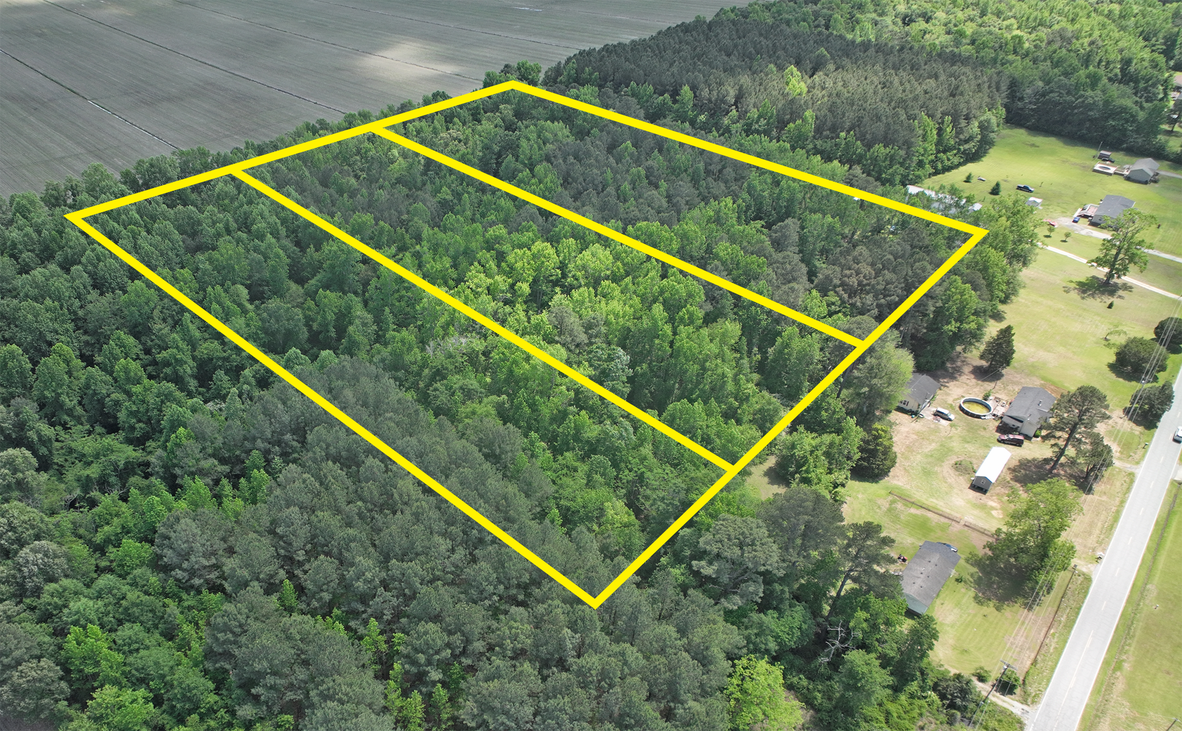
40+ acre property in Macon, NC
Jennifer Schrimper of First Class Real Estate (Rocky Mount NC) contacted us to get aerial images of a 40+ acre property in Macon, NC. We were on site the next day, and delivered marketing images within 24 hours.
Thank you Jennifer Berry with Taylor-MuellerRealty in Elizabeth City NC.
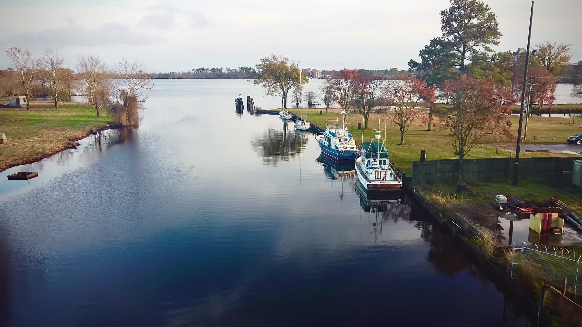
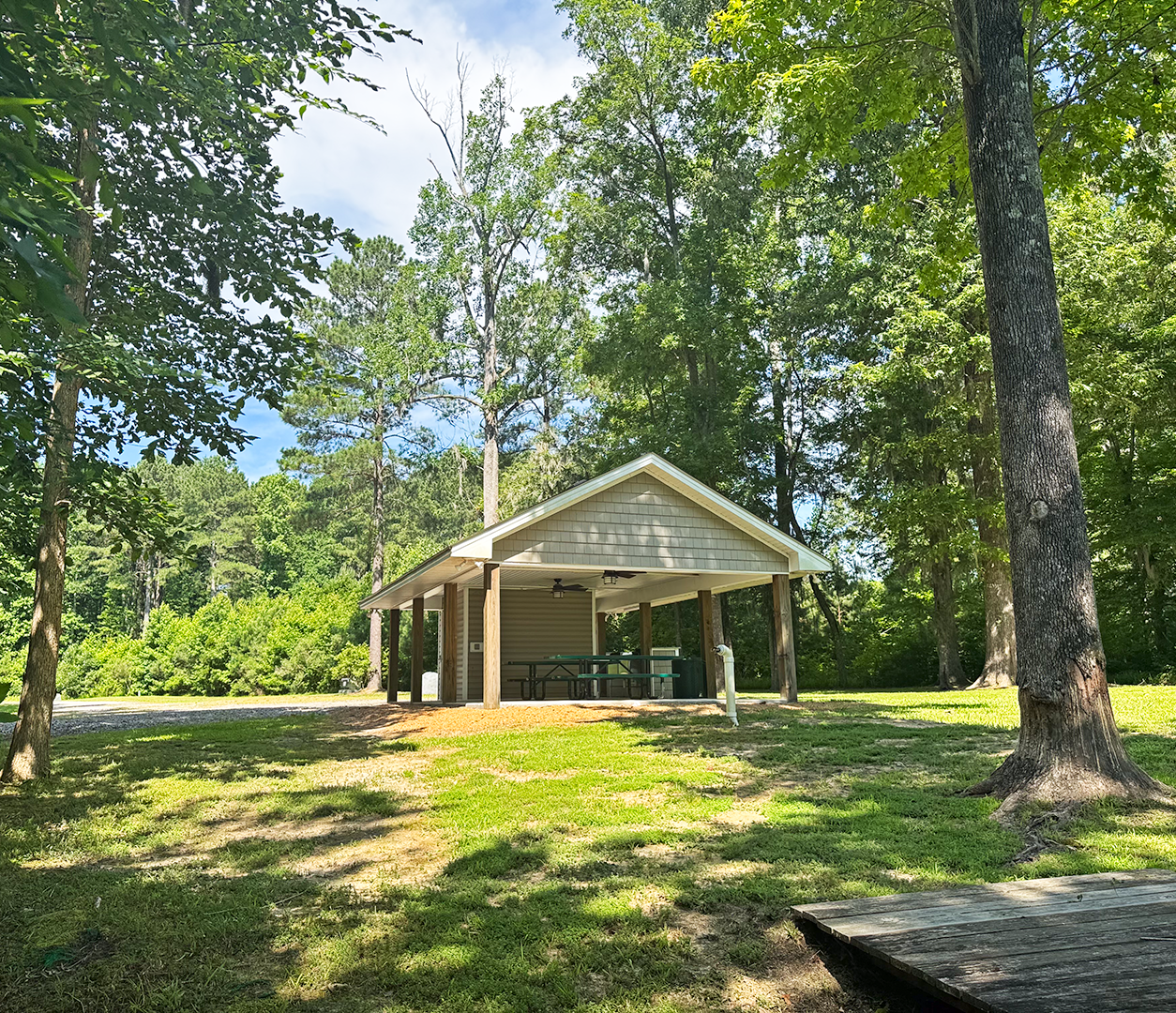
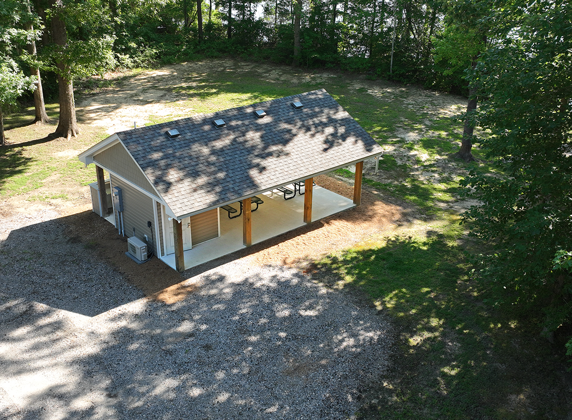
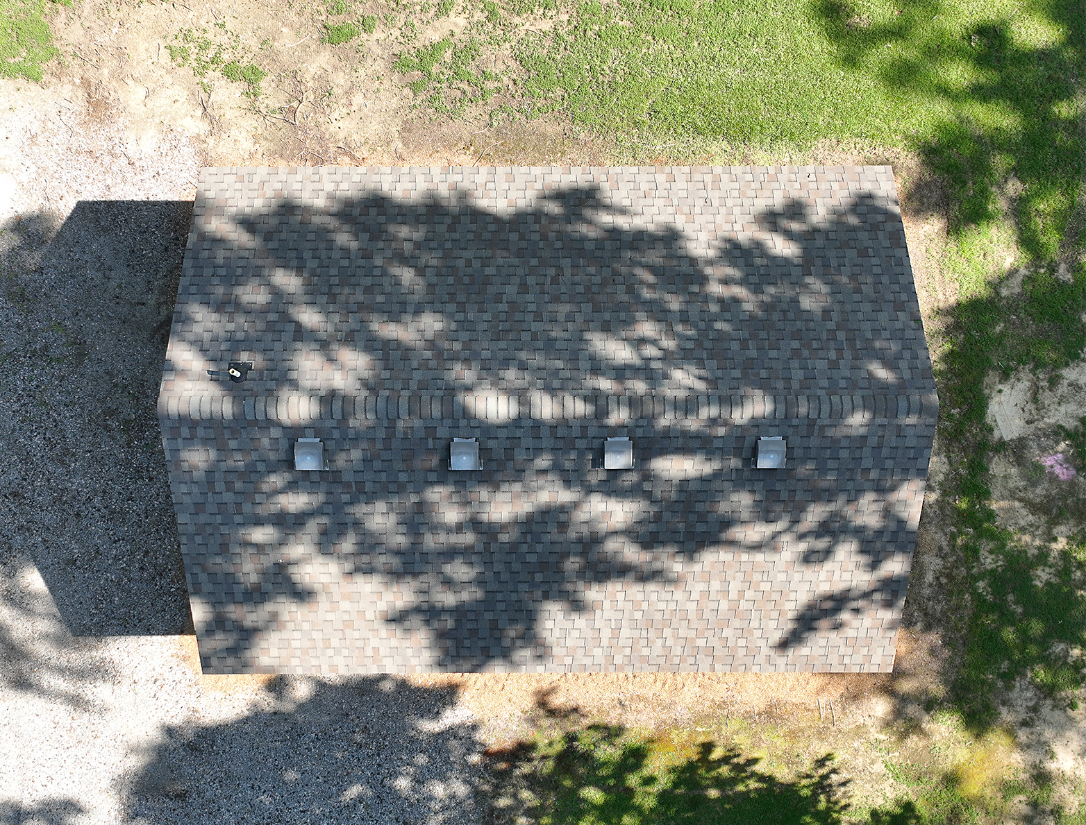
A particularly private, and beautiful small dock and small event building on the Yeopim River. Christina Townsend of Brown Properties of NC contacted A17 after finding our website. She asked if we could capture this small, beautiful river facility with a multi-slip dock on the historic and beautiful Yeopim River near Edenton NC. We were able to capture images and video, then edited together a small media package that Christina will use to market the property. If you manage commercial and private real estate sales, and need reliable and efficient aerial documentation, please contact us at rick@aerial17.com, or visit our website at Aerial17.com and fill out an information request.
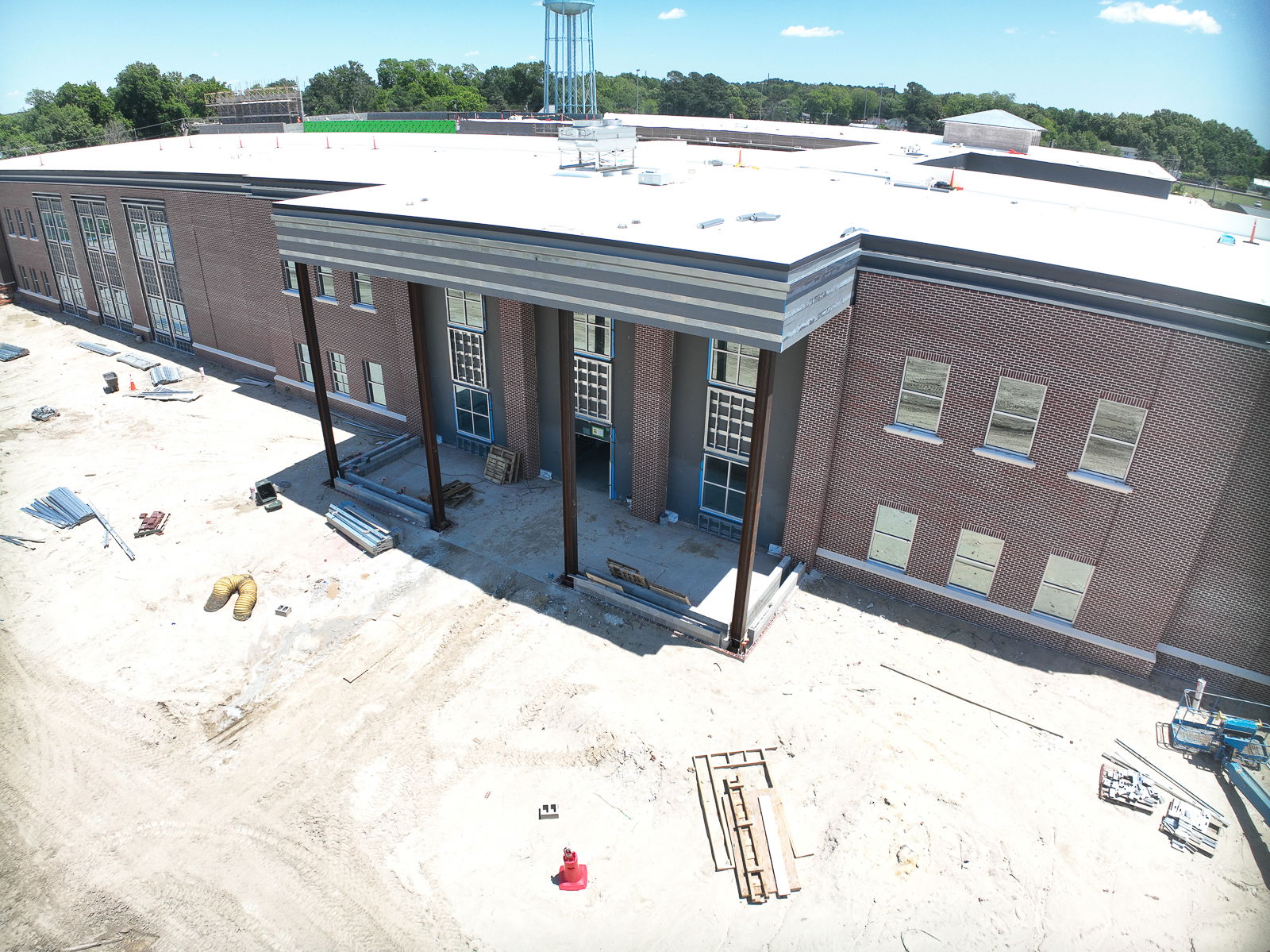
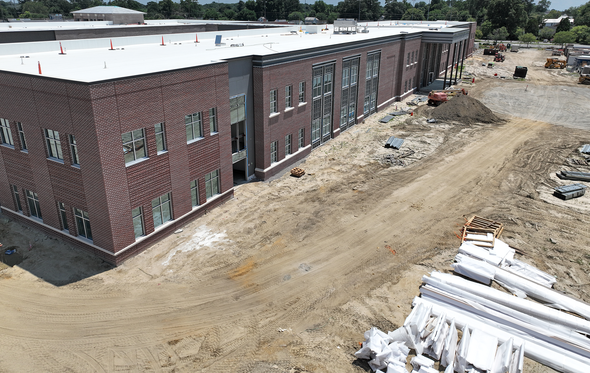
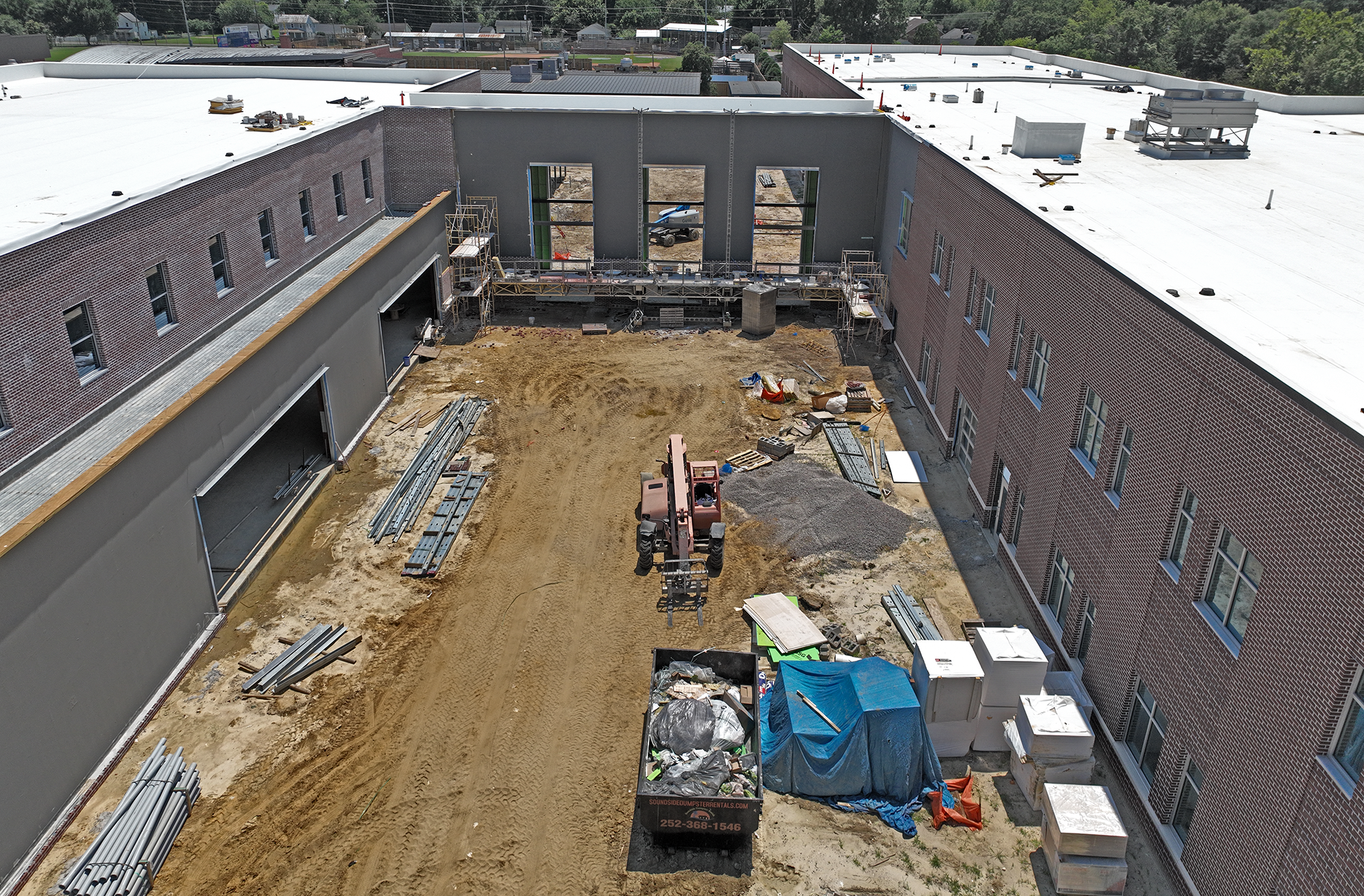
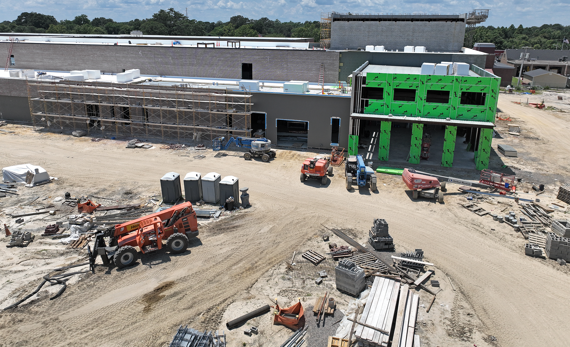
Learn about the latest developments and progress in the John A. Holmes High School Replacement Project located in Edenton, NC, as the community advances towards enhancing educational infrastructure. In this Spring/Early Summer update, discover current development milestones, reflecting the dedication to providing a modern and forward-thinking learning environment for students.
As spring turns to early summer, the transformation of the new John A. Holmes High School continues at an impressive pace. The main academic building is nearing exterior completion, with brickwork almost entirely finished. Inside, substantial progress is underway with electrical wiring, plumbing, and drywall installation bringing classrooms and corridors to life.One of the most exciting developments is the new theater. What began as a sandy excavation has quickly taken shape, with the seating pit and stage area now clearly defined. We anticipate that the roof will be in place within the next few visits, allowing interior finishes to begin soon after.It’s remarkable to witness this project evolve from blueprints to a state-of-the-art learning environment for the Edenton-Chowan community. If you are part of a major construction project that needs reliable and efficient aerial documentation, please contact us at rick@aerial17.com, or visit our website at Aerial17.com and fill out an information request.
Construction monitoring for leased property.
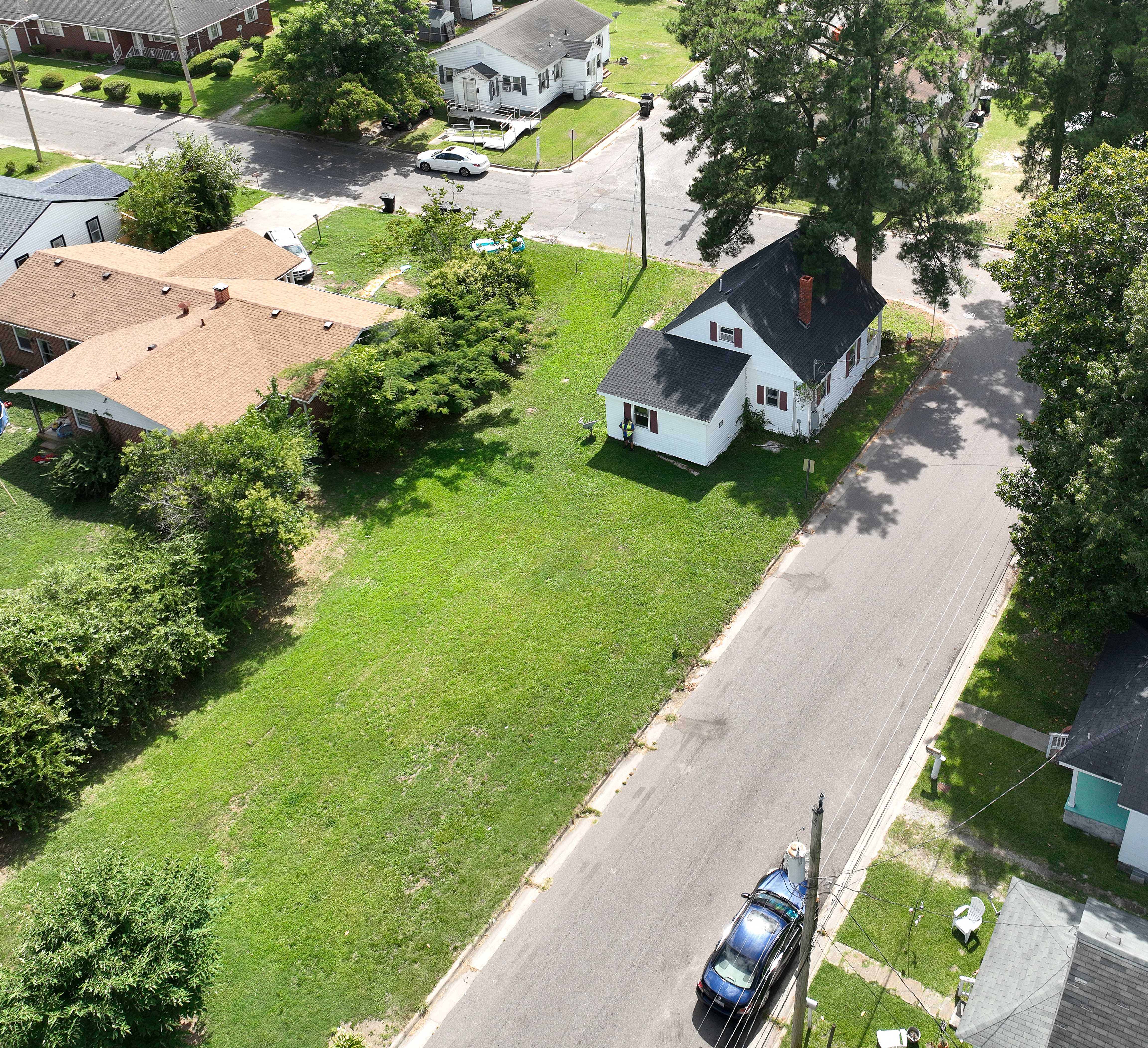
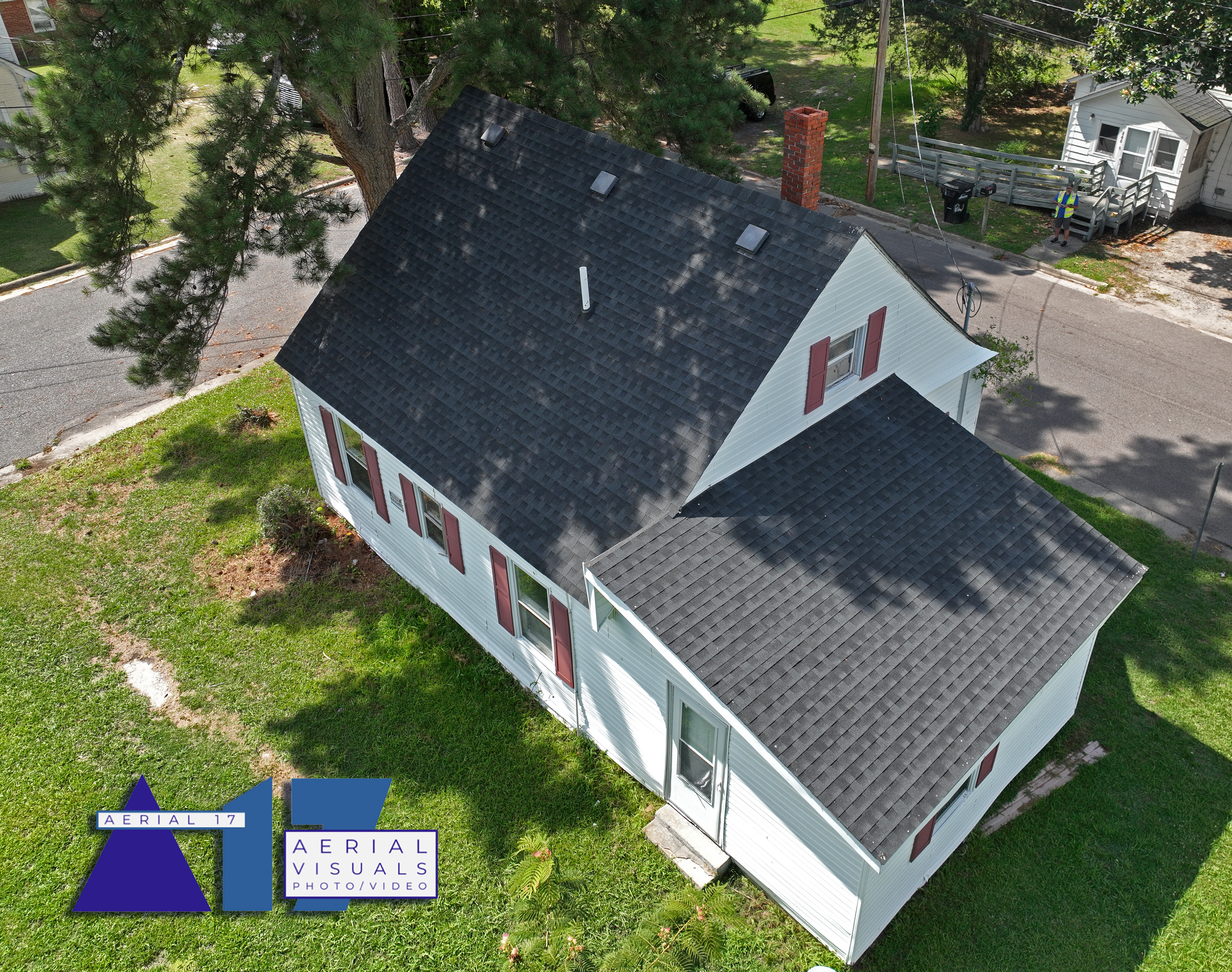
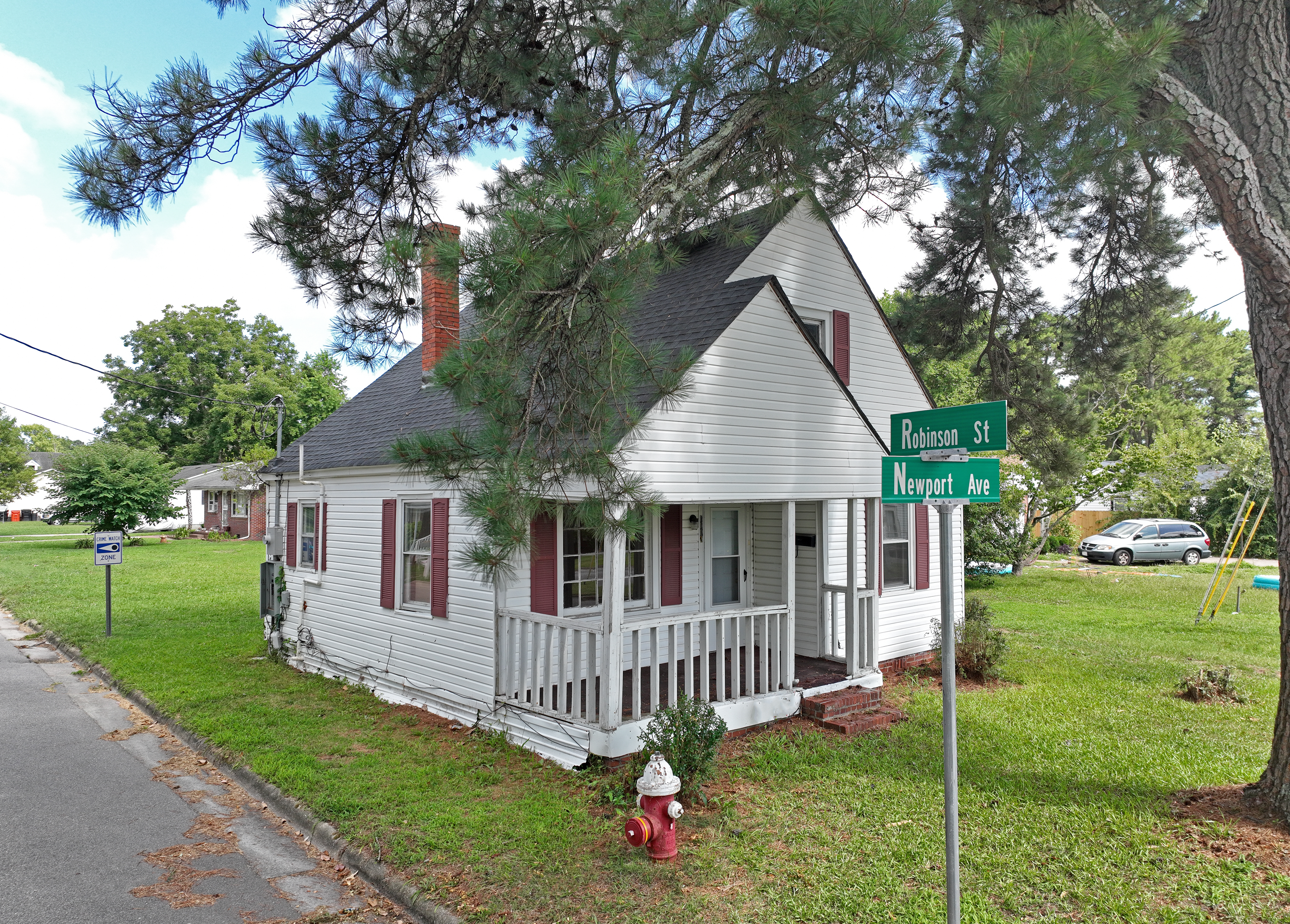
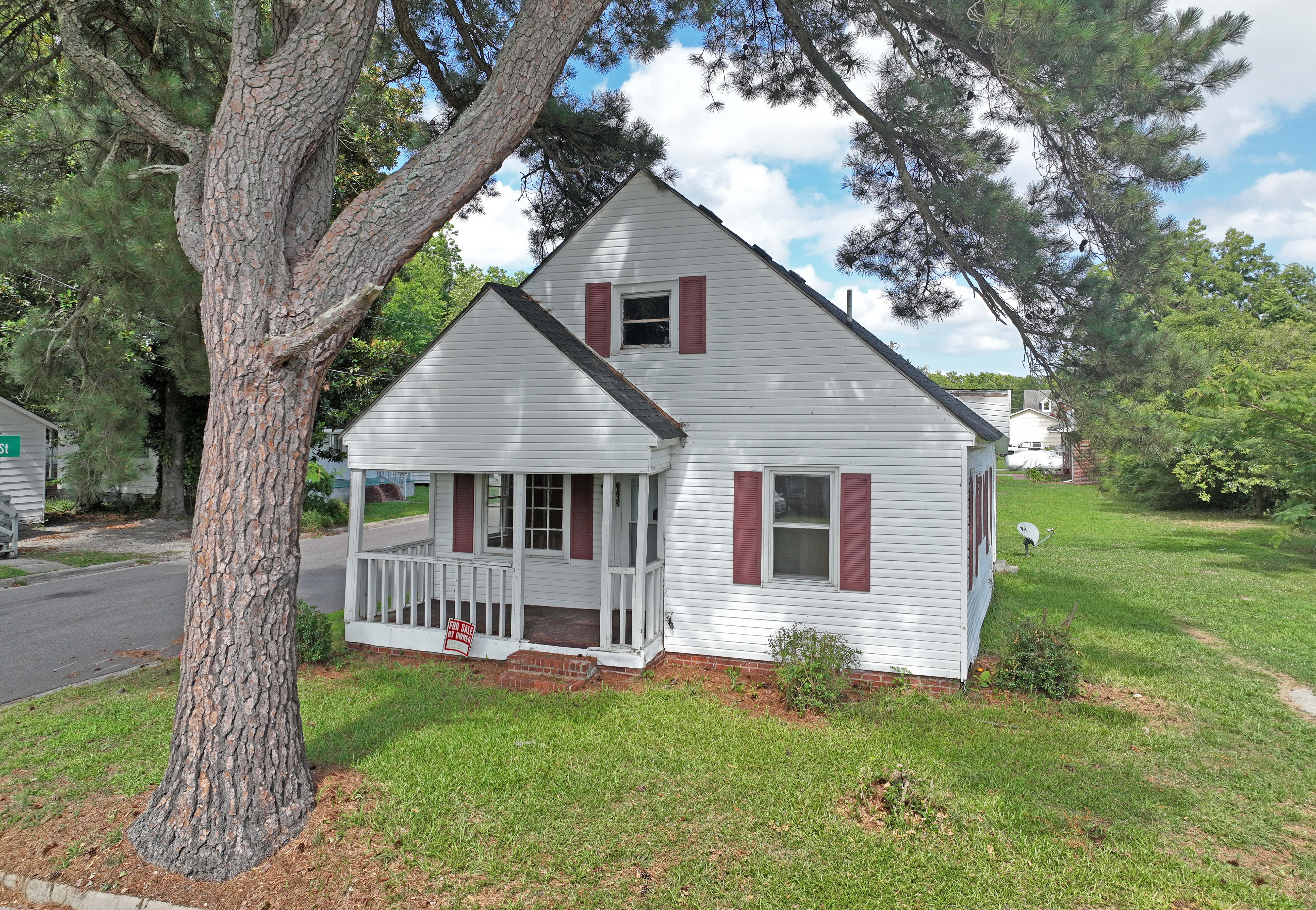
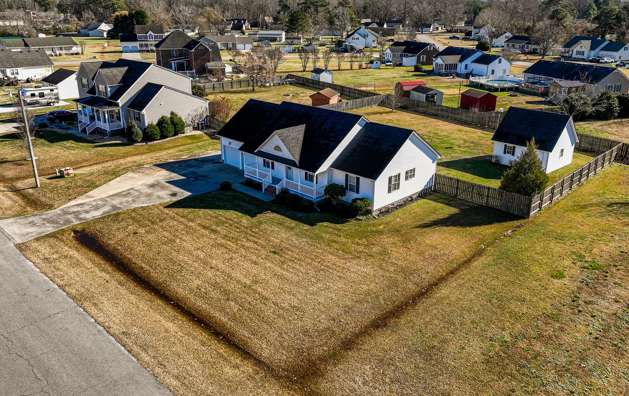
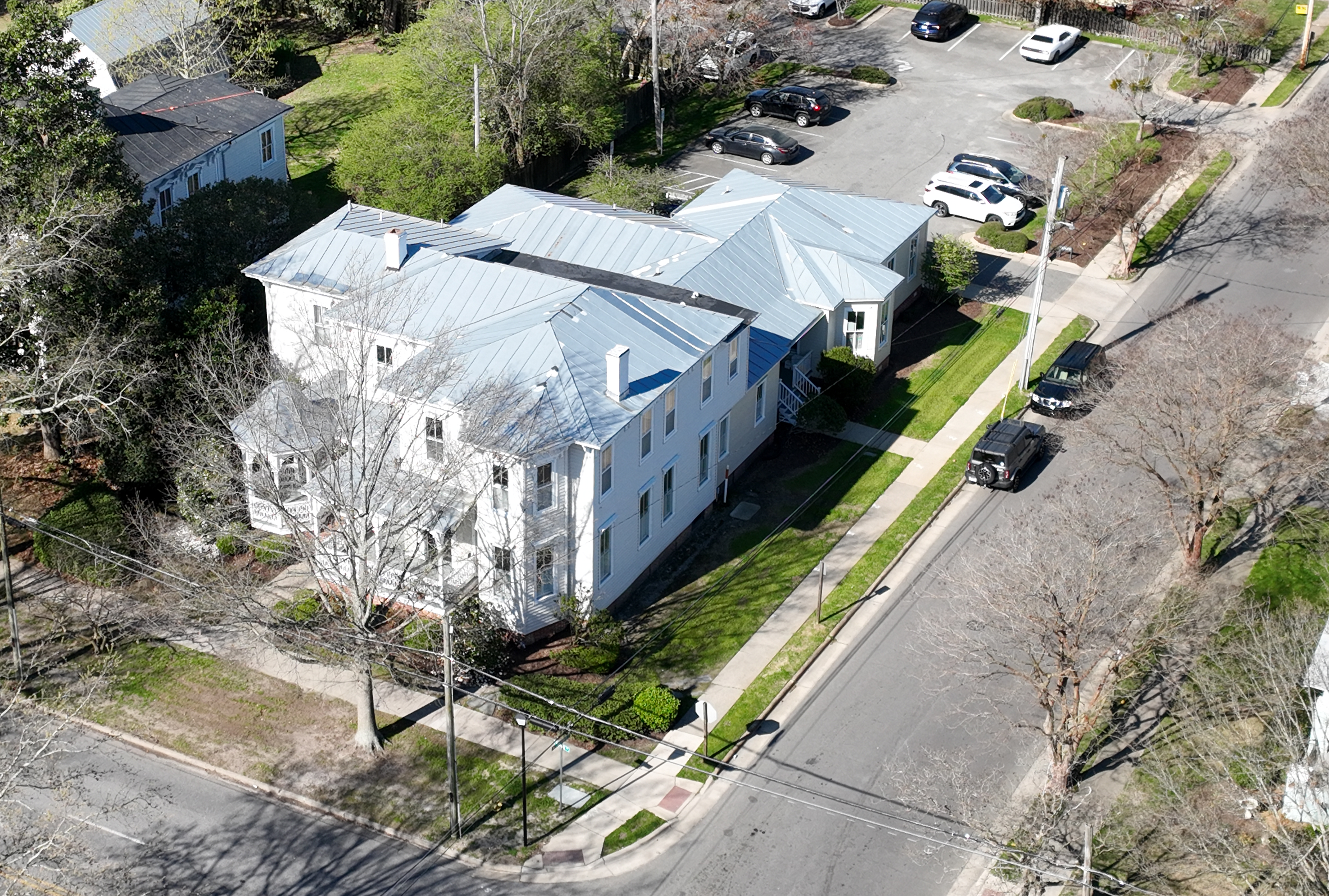
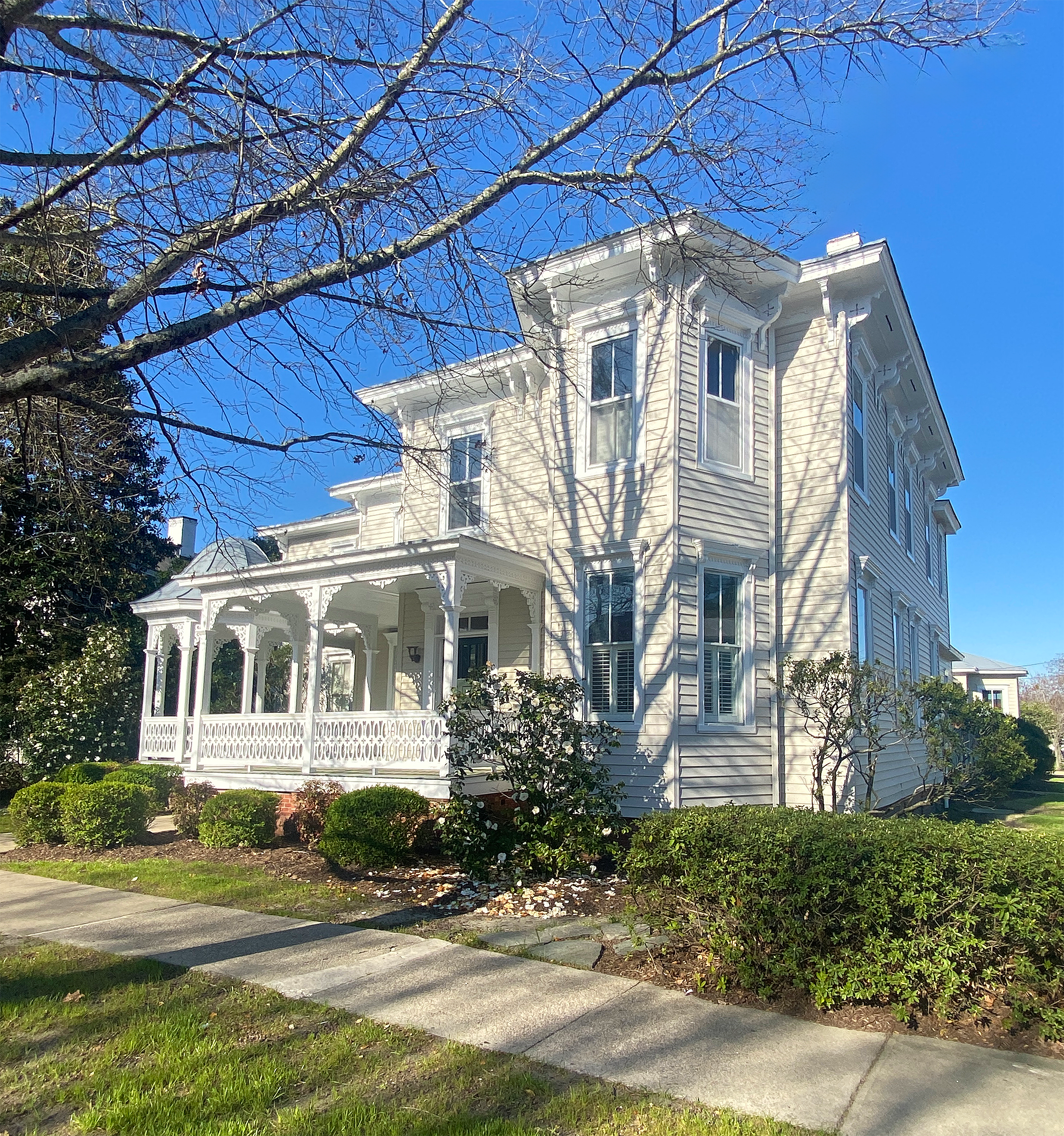
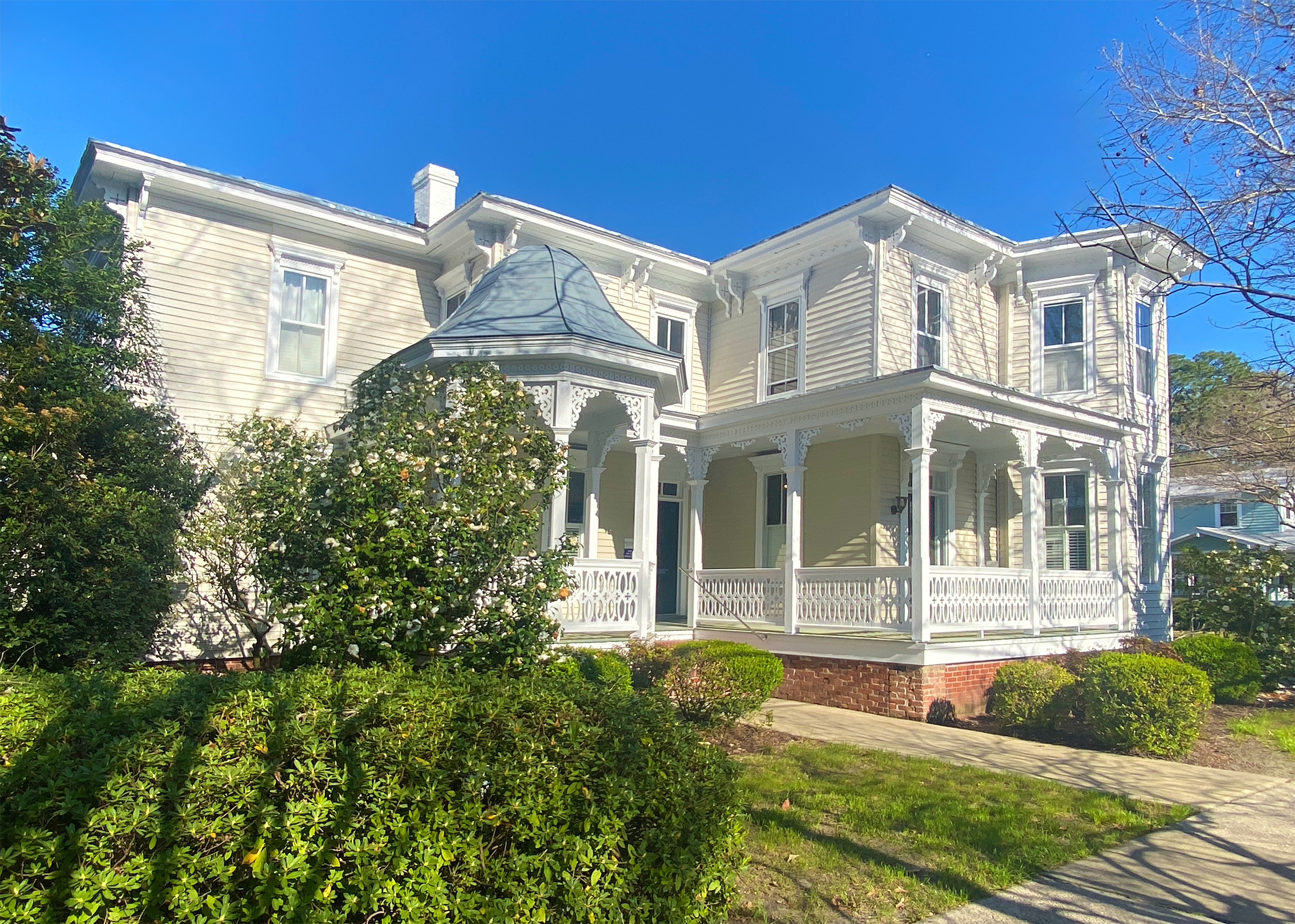
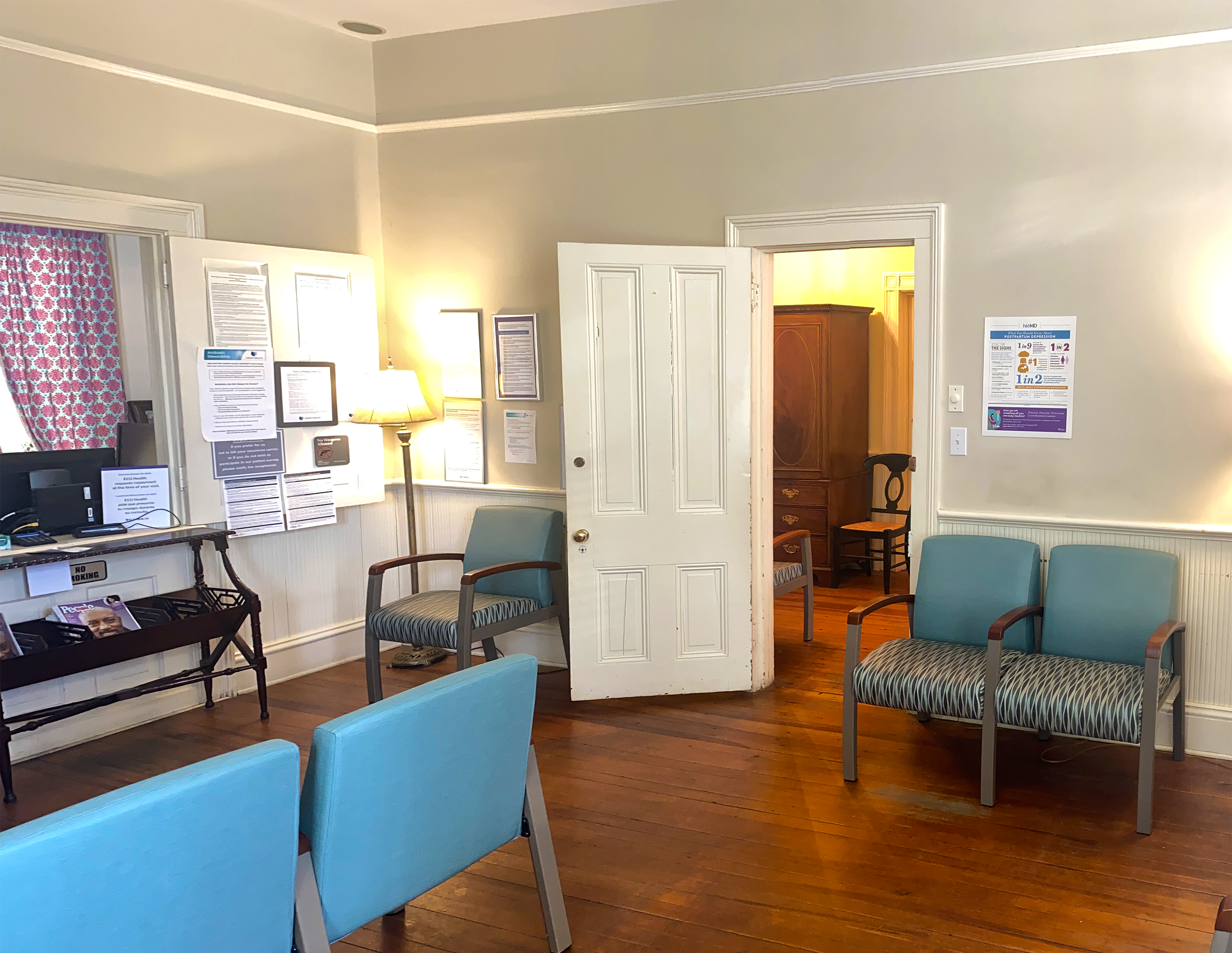
Thank you Mr. Jenette of Raleigh NC
Thank you Norma James from Taylor Mueller Realty.
Construction phase documentation for Chowan County contract to update John A. Holmes High School in Edenton, NC. Project is expected to run through 2026. Working with M.B. Kahn has been an illustration in excellent communications, and efficiency. Very grateful M.B. Kahn accepted my work proposal.
Butler Parachute Systems, based in Roanoke, VA, manufactures high-quality parachute systems for various applications, including emergency egress and military missions. With a newly renovated, 21,000 sq. ft. facility, they ensure reliable testing and production. Butler Parachute Systems has received federal awards, highlighting their reliability and quality. This was a shoot to highlight the facility expansion into the property footprint.
longer project documenting property expansion improvements, events, etc.
Thanks to Ben Bloodworth at Teams / Partner Commercial in Raleigh for this opportunity.

Thank you for contacting Aerial 17. I look forward to answering any questions concerning aerial photography, videography, construction progress and property mapping.